The following comprises notes on the Palisades Shared Use Path Feasibility Study (the “Study”) whose goal was to develop options to increase active transportation along the corridor connecting the Mario M. Cuomo and George Washington Bridges.
Links: Palisades Shared Use Path Feasibility Study, Bergen-Rockland Active Network
P. 24 – Public Engagement
Largely absent from the Study’s conclusions was meaningful input from area bike clubs (Rockland Bicycling Club, Bicycle Touring Club of North Jersey, New York Cycle Club) whose members regularly bike the study area and whose ride libraries contain routes which could have been appropriated as preferred alignments.
Nor does the Study reference local bike commuter group like Bergen County Complete Streets.
Evaluation of Proposed Routes / Recommendations
P. 35 – ID #01 Henry Hudson Drive / Main Street
The Henry Hudson Drive, which traces the contours of the Palisades from sea level to it’s crest has been a magnet for the region’s cyclists for decades. So it is remarkable that the Study declined to include so-called “Fast Cyclists” as recommended users.
Yet, despite the Drive’s rugged climbs, mile long descents and roadways pockmarked by falling rocks the Study did see fit to include “Slow Cyclists” and “Rollers”.
P. 39 – ID #05 – Tallman Mountain State Park Path
Similarly, “Fast Cyclists” are omitted as recommended users of Tallman Mountain Park’s crushed stone paths even though “gravel biking” is among the fastest growing categories of the sport.
P. 40 – ID #06 – Joseph P. Clarke Trail / Old Erie Path
“Fast Cyclists” are again omitted from the Joseph P. Clarke / Old Erie Path even though the alternatives are high traffic roads.
P. 42 – ID #08 – Lamont Observatory / State Line Lookout
At the southern terminus of State Line Lookout, the Study sensibly rejects routing users from the PIP overpass down the steep and rocky Forest View Trail. But it fails to note that a paved access road is immediately adjacent (mile 18.2).
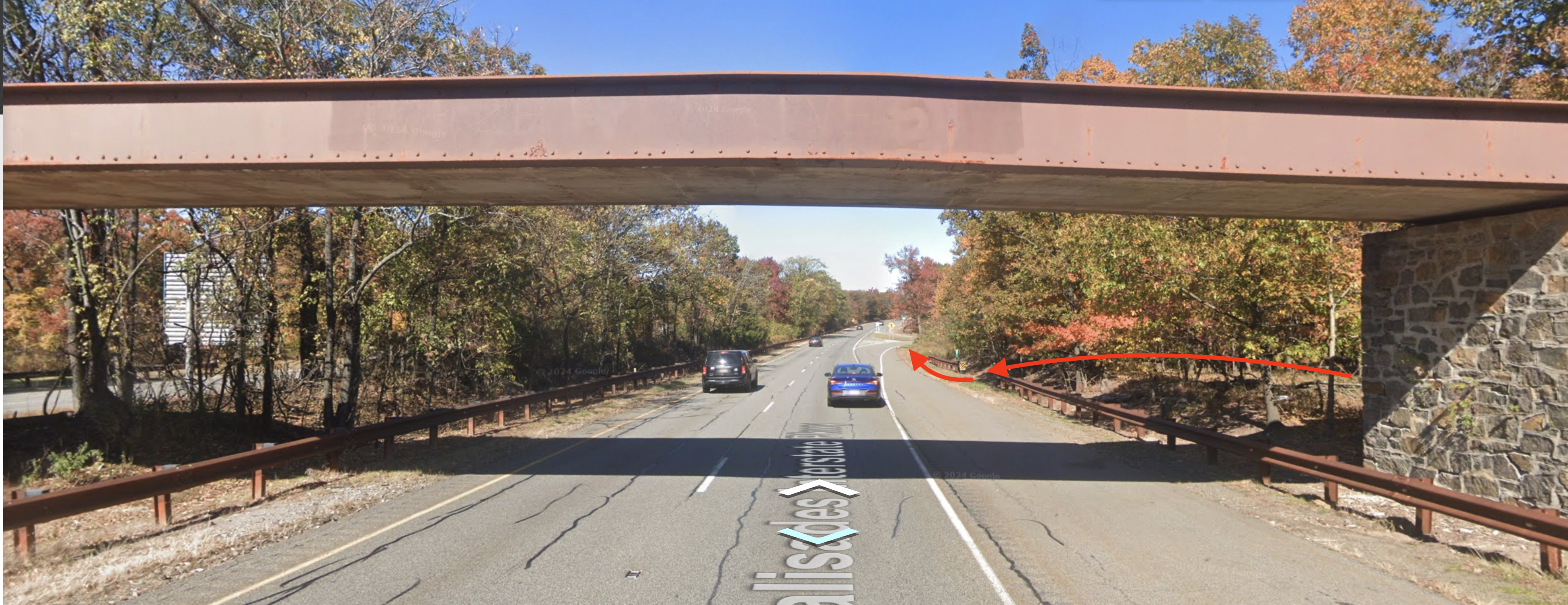
Palisades Interstate Parkway overpass looking north.
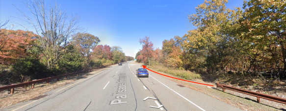
PIP looking north towards Stateline Lookout access road.
P. 43 – ID #09 – CSX / Bradley Parkway / Waldron Ave
The Study rejected a proposed alignment connecting West Nyack and Teaneck along the CSX right of way, citing the low likelihood of acquiring the rights, but it neglected to evaluate a parallel alignment along public roads.
New Jersey
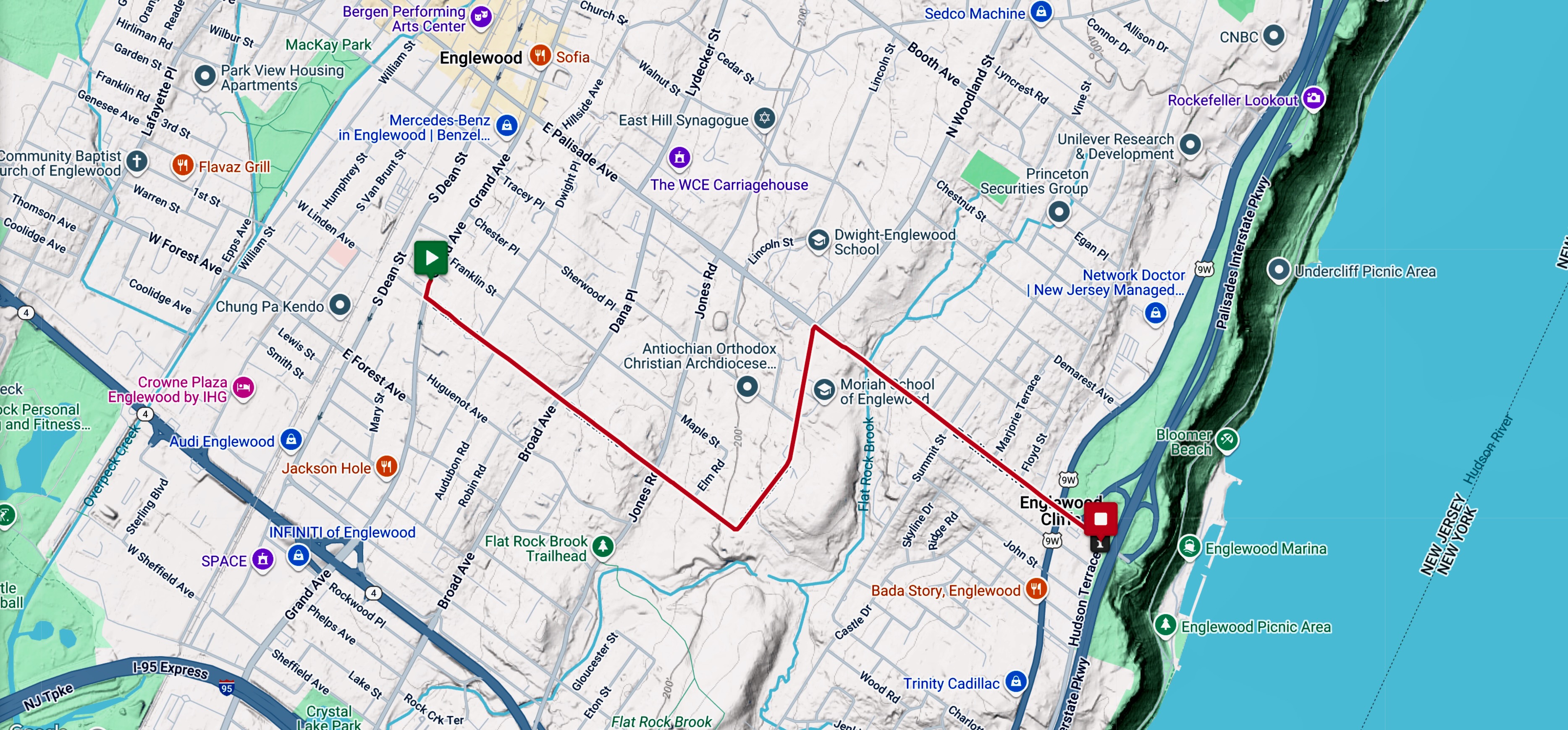
P. 46-50 – ID #12-16 – Closter Dock, Hillside, Hudson, E Clinton, E Palisades Aves [East-West Connections]
The Study proposes adding separated paths to high traffic, arterial roads to Route 9W with municipalities to the west. But even if such road diets were technically or politically feasible, that wouldn’t mitigate the roads’ steep grades. Rather, less direct approaches along low traffic residential roads that cyclists regularly travel would require minimal intervention. Examples:
ID #16A – Palisades … Church (Westbound)
ID #16B Linden … E Palisades (Eastbound)
NOTE: The proposed design includes replacement of the sidewalk on south side of Palisades Ave between S. Woodland St. and Summit Ave with a paved bike path.
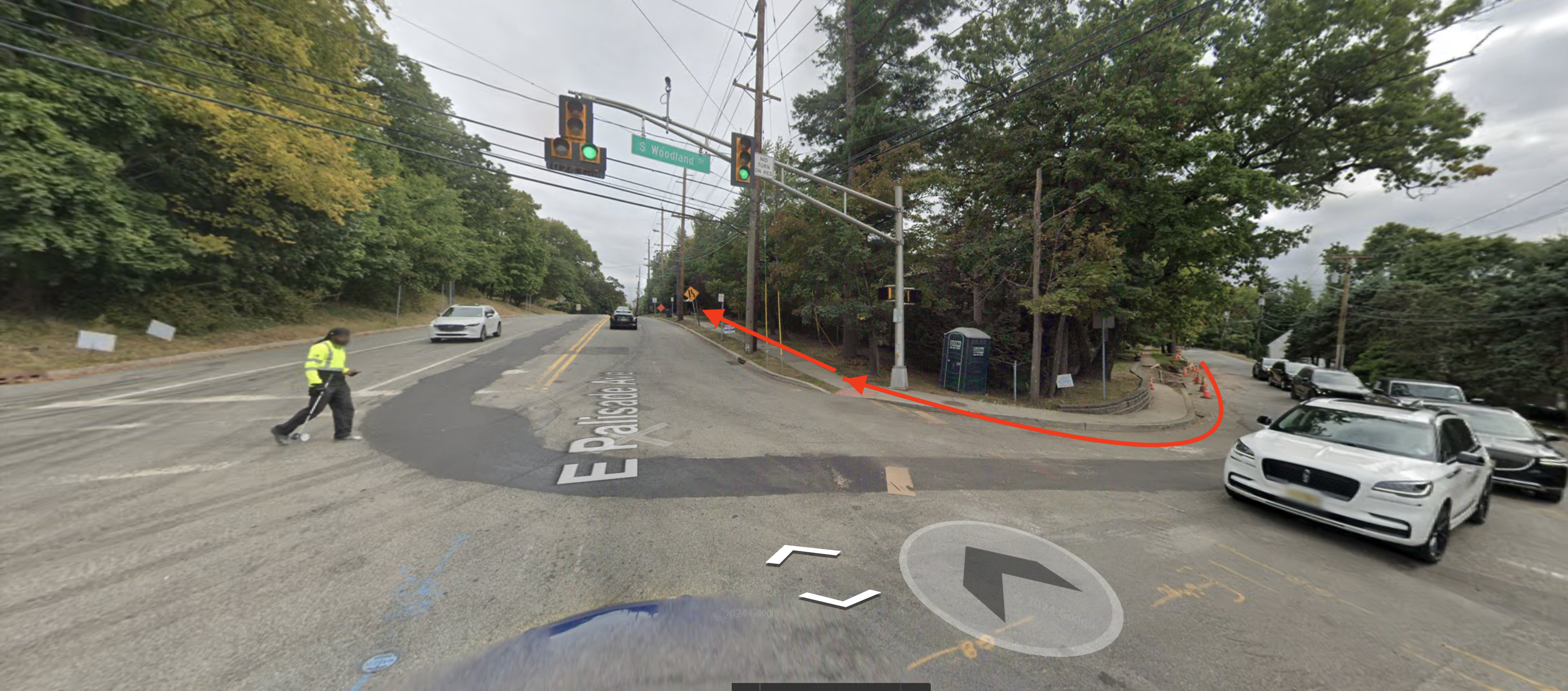
View from Palisades Ave looking west across S. Woodland St.
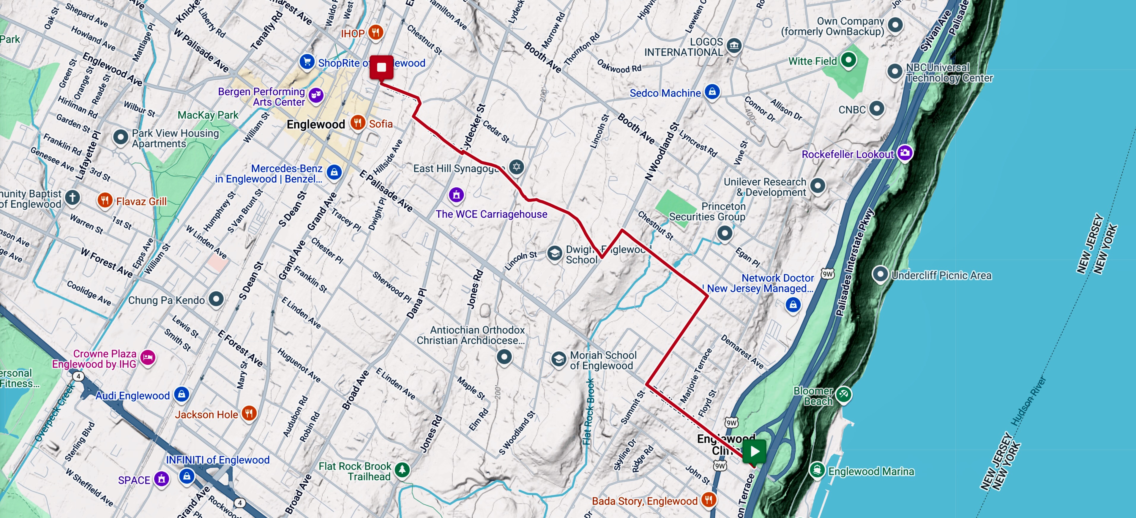
P. 51 – ID #17 – Hudson Terrace (Last Mile Connection to the GWB)
The Study proposed creating a two-way bike path on the east side of Hudson Terrace to access the George Washington Bridge paths. This poses multiple problems: including the quantity and extreme speed disparity of likely users; that the Terrace just north of the GWB comprises a 5% grade; that a path could not be made wide enough to safely facilitate two-way travel; and that southbound cyclists would have to merge across oncoming traffic to access the GWB paths. Alternate proposals:
ID #17A – Hudson Terrace – Slow Cyclists (Northbound)
The proposed design for Casual Cyclists heading north is a one-way protected bike lane for 0.2 miles leading to a striped shoulder running from Riverview Lane to Palisades Ave. Avid Cyclists would have the choice of using the protected lane or sharing the road with cars.
Hudson Terrace at GWB facing north
ID #17B Hudson Terrace – Fast Cyclists (Southbound)
For Fast Cyclists heading south, it is proposed that they continue to share the road with cars, but with the addition of signage and sharrows indicating that they will be merging left as they approach the GWB. Also, at the GWB entrance, provide a bike box and left-hand turn signal.
Ayre Associates
ID #17C – Hudson Terrace – Slow Cyclists (Southbound)
For Casual Cyclists, the alternate route would veer right off Hudson Terrace into Linwood Park, south along Central Rd, left onto Sylvan Blvd and right onto Hudson Terrace before making the left onto the GWB.
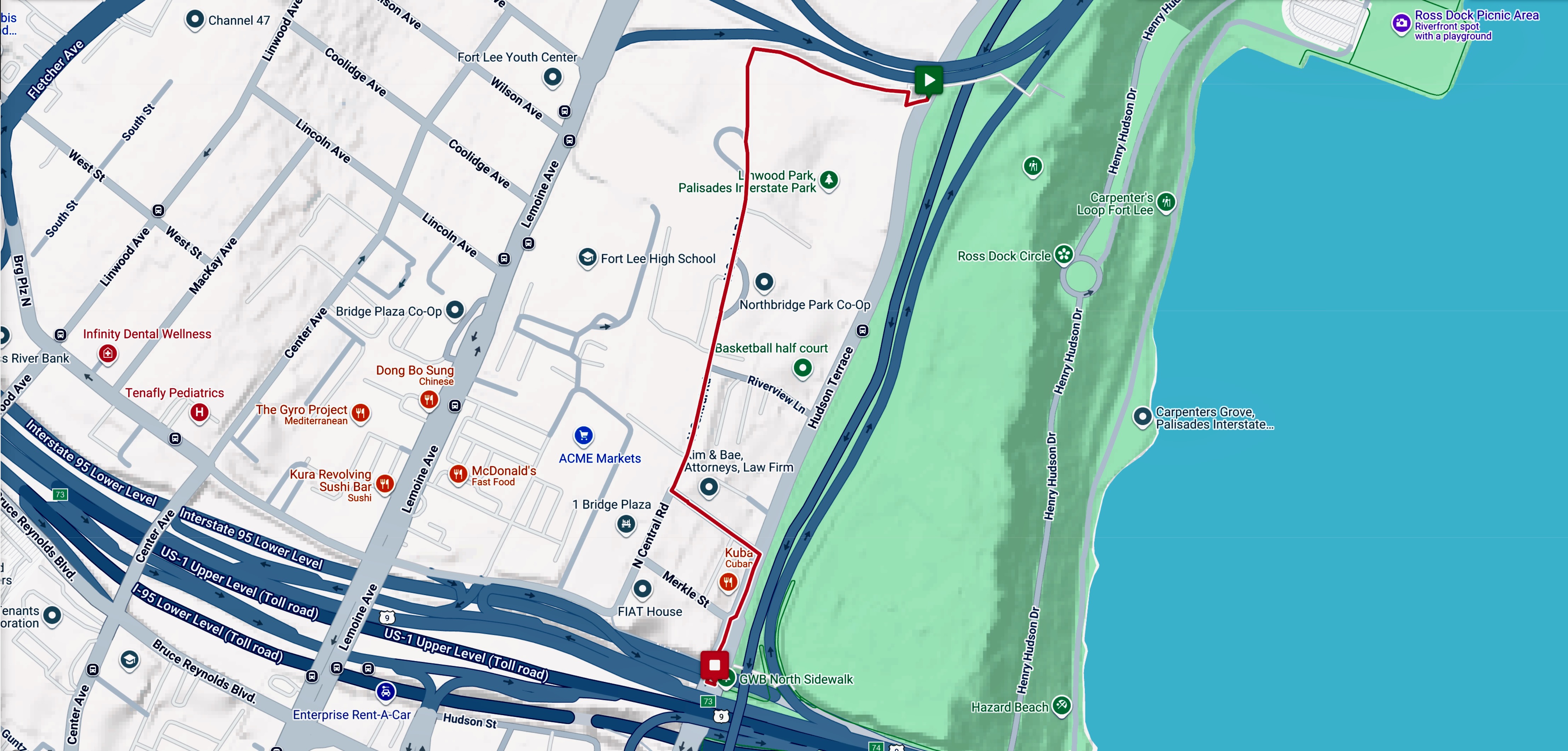
Last Mile Connection to GWB
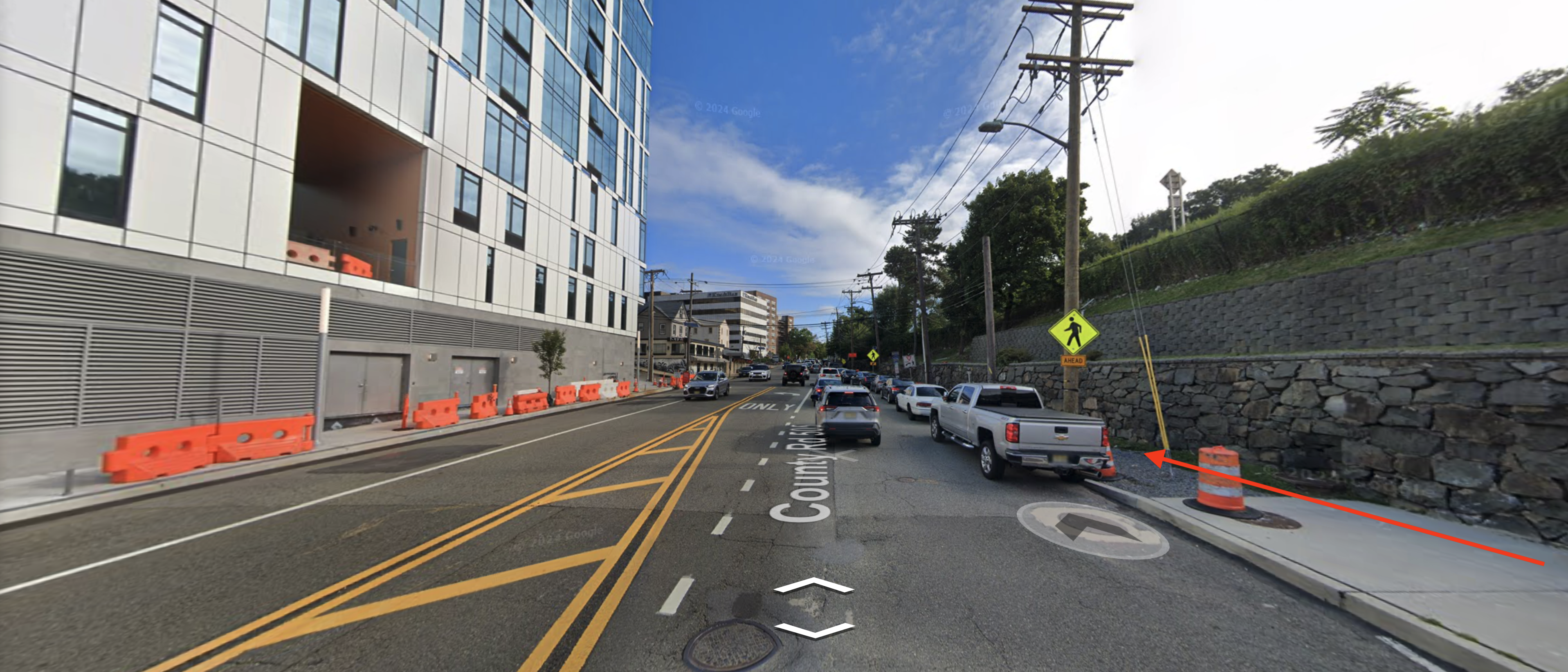
P. 52 – ID #19 – Main Street / Jones Road
Rather than route bikes onto a heavily trafficked Main Street, an alternative alignment would replace the sidewalk along Kirby> Bruce Reynolds with a one-way bike path.
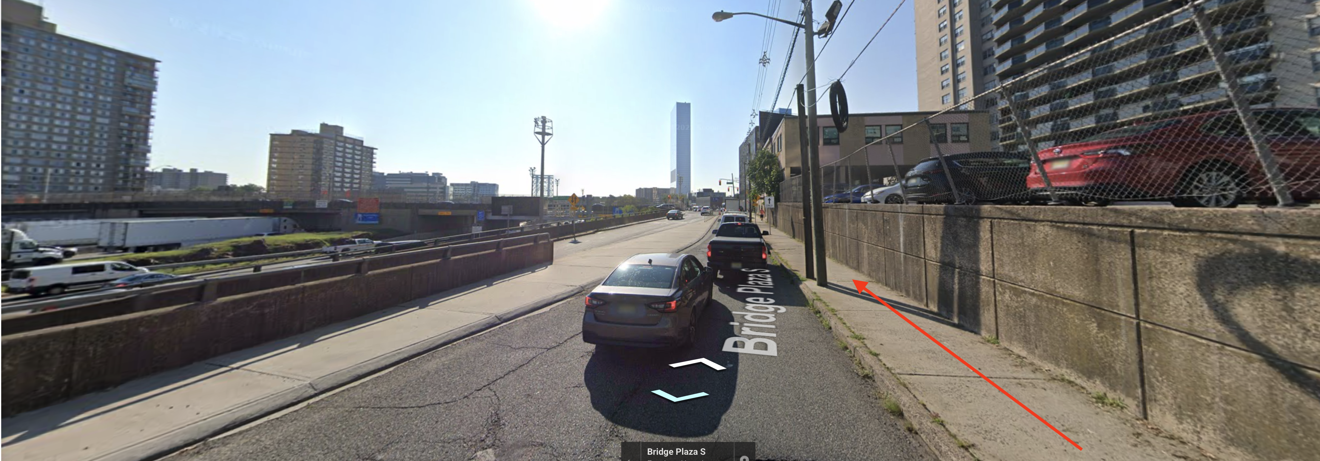
Bruce Reynolds Blvd looking east.
Takeaways
The Study appears to oversample the opinions of those who are unlikely to bike-run-or-walk any meaningful distance outside their immediate neighborhood and who are therefore indifferent, if not opposed, to increasing active transportation along the MMC-GWB corridor.
Sadly, the Study fails to leverage the collective experience of the cycling community—a cohort uniquely qualified to address the problem.
Ultimately, the Study produced no workable alignments connecting the Bridges, even though cyclists have been biking the corridor for decades.
Bio
Neile Weissman heads up Complete George, a bike advocacy whose campaigns include getting wider bikeways across the George Washington Bridge; the Grayways proposal to designate 500 miles of recreational bike routes connecting NYC parks; and passing Stop as Yield legislation which allows cyclists to treat stop lights as stop signs, and stop signs as yields.
Neile is also Public Relations Director for the New York Cycle Club, for whom he has organized some fifteen hundred rides across the tri-state area.
